Prospective Students*
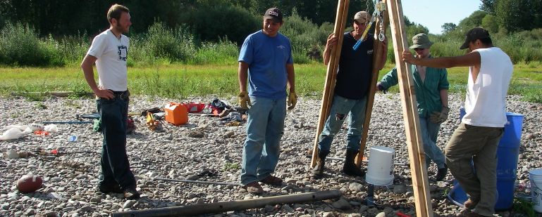 Graduate students and research assistants installing fiber optic temperature probe on the Willamette River,
Oregon, 2007. From left: Drew Bryenton
(MS, Env. Eng.), Graysen Squeochs (MS, Water Res. Sci.), Travis Cheney (volunteer), Mark Williams (MS, Marine Geol.
Geophys.), Michael Bushman (Res. Asst.)
Graduate students and research assistants installing fiber optic temperature probe on the Willamette River,
Oregon, 2007. From left: Drew Bryenton
(MS, Env. Eng.), Graysen Squeochs (MS, Water Res. Sci.), Travis Cheney (volunteer), Mark Williams (MS, Marine Geol.
Geophys.), Michael Bushman (Res. Asst.)
* Please see the "Links" page for lists of current and past students.
I advise students in the following programs: Geology, Geography, Water Resources Engineering,
and Water Resources Science. I have also advised a student in the Environmental Engineering program.
I will be on sabbatical during the fall and winter terms of the 2008-09 academic year. I may still take a new graduate student to start in fall, 2009.
Funding Opportunities
Most new students in the Department of Geosciences are funded by Graduate Teaching Assistantships (GTAs), which are typically offered to the top applicants. I can usually offer one student a GTA.
Possible Projects
Migration corridor for the Missouri National Recreation River:
funded by the National Park Service (NPS). This study with Robb Jacobson (USGS-BRD)
will develop a model for predicting the migration of this relatively free-flowing,
braided reach of the Missouri River on the Nebraska-South Dakota border in order to
delineate a 100-year migration corridor. The first step will involve incorporation
of a river meandering model well suited for predictive modeling within the
Channel-Hillslope Integrated Landscape Development model (CHILD).
While incorporation and calibration of the meandering model are seen as
necessary first steps, additional work will be necessary to account for the braiding
of the Missouri River. Only the first steps are currently funded by the NPS, but we are
optimistic that additional funding will be forthcoming.
Debris flows and climate change on Cascades volcanoes:
Small Grant for Exploratory Research (SGER) funded by the National Science
Foundation (NSF). With Anne Nolin (of OSU as PI) and others, this study addresses the mechanisms behind periglacial debris
flows such as those seen on Mt. Hood and Mt. Rainier in November, 2006, and to
determine whether climate changes have already increased their frequency and/or
are likely to do so in the future. We will be using LiDAR, high-resolution satellite
imagery, climate reanalyses, and field studies to investigate the role of decreasing snow pack, retreating
glaciers, and increasing frequency and/or magnitude of severe rainstorms.
Sediment storage at the transition between debris-flow and fluvial
processes: funded by the National Science Foundation (NSF).
This involves: (a) examining the influences of basin size and network
structure (i.e., morphometry) on depositional processes and sediment
evacuation times through mapping, stratigraphy, and radiocarbon dating
but also using high-resolution laser altimetry to estimate sediment volumes
and develop and apply measures of network structure; (b)
investigating the origins of bedrock (strath) terraces and their
associations with debris fans and, possibly, climate change through
mapping, stratigraphy, and dating of fan and valley-fill deposits. One
student has just finished work on (b), and another has just begun work on (a).
Evolution of landscapes dominated by debris flows
(Collaborative Research with Greg Tucker of CU-Boulder): funded by NSF. This study will
use landscape evolution modeling, high-resolution laser altimetry, and
morphometric analyses to study the processes responsible for steepland
valley and longitudinal channel profile evolution in the Oregon Coast Range and
the Italian Apennines. For example, is scour by debris flows necessary
to form these valleys, or is the accelerated physical weathering that
occurs in hollows and valleys recently denuded by landslides and
debris flows sufficient to produce the observed topography? This study
will utilize a landscape evolution model (which my colleagues and I
have developed) that incorporates soil production and diffusive
hillslope transport; fluvial incision and sediment transport; lateral
river migration, or meandering; overbank (floodplain) deposition;
eolian deposition; and tectonism. (This model could also allow a
number of different studies.)
Hyporheic flow, water temperature, and big rivers:
pilot project funded by NSF. Roy Haggerty (of OSU) and I are studying
the heat budget of hyporheic flow (defined as flow that originates in
the river, travels through the shallow subsurface, and reemerges in
the river) through gravel bars on the Willamette River in Oregon. We
want to study any effects of hyporheic flow on summer peak
temperatures. The eventual goal is to see whether allowing the river
to migrate (at least in some reaches) by removing revetments can
actually have the beneficial effect of decreasing summer peak stream
temperatures. Eventually, this might involve predictive modeling of
river migration using a study of bank erodibilities by a recent MS
student as a calibration of the meandering model. While our current
funding would not be enough to fund a prospective student, we plan to
follow up on this study with other proposals to NSF and/or local sources.
Interactions among the forest, debris flows, and the fluvial
system: project funded by the National Council for Air and Stream
Improvement, Inc. (NCASI), a forest-industry-funded consortium.
I (with Gordon Grant of USFS PNW Research Station) am
studying the effects of forest management practices on rapid mass
movements and the implications for aquatic habitat through simulations
with a model I've developed. I don't currently have funding for a student,
but more funding from NCASI or other sources might be forthcoming.
Glacial-fluvial interactions.
My colleague in Geosciences, Andrew Meigs, and I are trying to
solidify a proposed collaborative study of the interactions between
fluvial and glacial systems. Specifically, we have (mainly, he has)
been looking at places where streams have been recently "undammed" by
glaciers in Alaska. Possible topics might include: modeling this interaction or
doing field work in order to examine the major controls on sediment
storage and yield; modeling this interaction in order to examine its
effects on fluvial valley morphology.
Distributary networks.
Richard Keim (LSU, Natural Resources) and I are working on a proposal
to study distributary networks and the implications for forest
succession in the Atchafalaya basin of Louisiana.
Of course, topics other than these are possible, but these are the
ones for which I have proposals either submitted or in the works.
© Stephen Lancaster
HOME
Stephen Lancaster
Last modified: Thu Aug 28 2008
|